 Most viewed - Pilbara negative and digital Albums - non iron ore |

237-27536 viewsTambrey Station ruins. Geodata . More information can be found here .
|
|

160102 9832534 viewsWittenoom Gorge, eastern wall of gorge view, around Fifth Crossing. Geodata.
|
|

160101 9799533 viewsWittenoom Gorge, Gorge Mine area, view of old plant footings looking down from third level. GeoData.
|
|
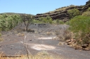
160101 9804533 viewsWittenoom Gorge, Gorge Mine area, looking north west, at the old waggon dump area and workshops. GeoData.
|
|
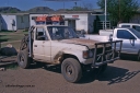
254-00533 viewsWodgina mine site, bull buggy from a cut down 60 series Toyota Landcruiser from Wallareenya Station.
|
|
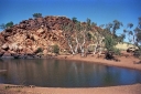
254-12533 viewsGreen Tank Pool, August 2001. Geodata location here.
|
|

140517-4422532 viewsA Tutt Bryant rope operated Pacific A.C.E. Equipment Wheel Loader, Fordson powered?? The front end loader which lifts the bucket over the cab to feed the trammel, or dump into a truck, see an historical picture of this unit here at the Battye Library and an image of a similar unit on the manufacturer's website
|
|
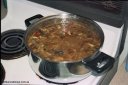
206-35532 viewsPossibly a spaghetti sauce.
|
|
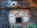
160710 iPh5S 2814532 viewsWittenoom Gorge, Colonial Mine entry adit #30 sealed up, but with the blanking plate removed and evidence of entry. Geodata.
|
|

237-29531 viewsTambrey Station, grave of T. D. Cusack, past manager. Geodata . More information can be found here .
|
|
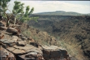
205-21529 viewsWittenoom, upper reaches of Bee Gorge, landscape views.
|
|

206-22529 viewsWhere Carawine Creek joins the Oakover River.
|
|
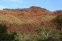
160102 9823529 viewsWittenoom Gorge, eastern wall of gorge view, around Fifth Crossing. Geodata.
|
|
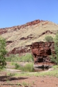
160102 9812528 viewsWittenoom Gorge, Town Pool in Joffre Creek just south of the Colonial Mine. Geodata.
|
|
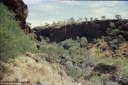
205-33526 viewsKoodaideri, area around this underground drive, drive location is 22 31'48.36" S 118 59'58.08" E.
|
|
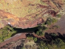
160101 DJI 0006526 viewsWittenoom Gorge, looking down on the pool in Joffre Creek between fourth and fifth crossings. Geodata.
|
|
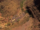
160101 DJI 0017526 viewsWittenoom Gorge, view from above the Gorge Mine area and pool, looking north east, campers at pool, the drive can be seen cutting up the left side of the gorge, foot print of mine and building area clearly visible. Geodata.
|
|

160102 DJI 0024526 viewsWittenoom Gorge, western wall of gorge view, looking west, Third Crossing. Geodata.
|
|
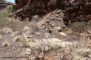
160101 9793525 viewsWittenoom Gorge, Gorge Mine area, asbestos mining remains, concrete slab of former building located along the mine railway, adit 3 is behind the pile of rubble. Geodata.
|
|

237-21525 viewsPilga Station ruins and old buildings. Geodata .
|
|
| 547 files on 28 page(s) |
 |
|
|
|
|
|
|
|
|
|
|
23 | |
|
|
|
|
 Login


