 Most viewed - Current_Wittenoom_Images |

160102 DJI 0024526 viewsWittenoom Gorge, western wall of gorge view, looking west, Third Crossing. Geodata.
|
|
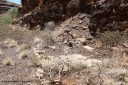
160101 9793525 viewsWittenoom Gorge, Gorge Mine area, asbestos mining remains, concrete slab of former building located along the mine railway, adit 3 is behind the pile of rubble. Geodata.
|
|
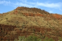
160102 9826524 viewsWittenoom Gorge, eastern wall of gorge view, around Fifth Crossing. Geodata.
|
|
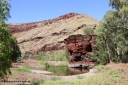
160102 9816523 viewsWittenoom Gorge, Town Pool in Joffre Creek just south of the Colonial Mine. Geodata.
|
|

160102 9824523 viewsWittenoom Gorge, eastern wall of gorge view, around Fifth Crossing. Geodata.
|
|

160102 9831523 viewsWittenoom Gorge, eastern wall of gorge view, around Fifth Crossing. Geodata.
|
|

160102 9822522 viewsWittenoom Gorge, eastern wall of gorge view, around Fifth Crossing. Geodata.
|
|
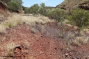
160101 9801520 viewsWittenoom Gorge, Gorge Mine area, looking east along the north wall with the drive line to the adits, old rails embedded in track. GeoData.
|
|
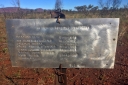
160711 iPh5S 2828520 viewsWittenoom cemetery located in the grounds of the old airport alongside the old north-west/south-east running runway. Sign placed in 2015. Location is here.
More details can be found on these two websites, Oz Burials, and WA4WD.
|
|

160101 9803519 viewsWittenoom Gorge, Gorge Mine area, old building slabs and foundations looking east. GeoData.
|
|

160710 iPh5S 2798518 viewsWittenoom Gorge, Colonial Mine, reverse view of 2797 looking north east back over the underground railway points on the upper level with the old building frame in the background.
|
|

160102 9827516 viewsWittenoom Gorge, eastern wall of gorge view, around Fifth Crossing. Geodata.
|
|
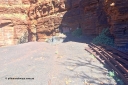
160710 iPh5S 2802514 viewsWittenoom Gorge, Colonial Mine, view looking across the level to adits #28 and #27. Tailings fill has eroded, old track points or switches stacked up. Geodata.
|
|

160102 9820509 viewsWittenoom Gorge, pool in Joffre Creek just across the road from Colonial Mine, Magazine Pool. Geodata.
|
|

160710 iPh5S 2789509 viewsWittenoom Gorge, old exposed mine adit of the Gorge Mine which was right up the very top of Wittenoom Gorge. Geodata.
|
|

160710 iPh5S 2787507 viewsWittenoom Gorge, Pyramid Pool looking north along the western wall of the gorge. Geodata.
|
|

160710 iPh5S 2791506 viewsWittenoom Gorge, near the old Colonial Mine, native banana palms. If you know, you know…
|
|

160710 iPh5S 2809505 viewsWittenoom Gorge, Colonial Mine, old underground 'jumbo' box for power distribution to electric pumps and drills. Jumbo is a modern mining term, so these would have been called something else…
|
|
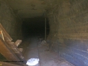
160710 iPh5S 2816503 viewsWittenoom Gorge, Colonial Mine adit #30, looking inside through the removed blanking plate. Geodata.
|
|

160710 iPh5S 2785500 viewsWittenoom Gorge, Pyramid Pool looking south along the western wall of the gorge. Geodata.
|
|
|
|
 Login


