 Most viewed - 030416 |

030415 154820522 viewsTarcoola, at the 504.5 km, looking south east along the No. 1 Water Road, set of points is the No. 2 Loco Road, No. 1 Loco and Camp Train roads are visible to the left. Water tank on stand. GeoData location. 15th April 2003.
|
|
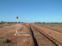
030416 084242520 viewsCarnes Siding located at the 566.4 km on the Central Australian line from Tarcoola to Alice Springs. View looking south from the north end of the goods siding rejoining the loop and the mainline at right. The train control 'pillbox' concrete hut is visible with the station nameboard the white item beside it. GeoData location. 1April 6, 2003.
|
|
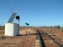
030416 084506517 viewsCarnes Siding located at the 566.4 km on the Central Australian line from Tarcoola to Alice Springs. Looking south from the north end of the loop, interlocking hut with repeater searchlight signal, point indicator and dual control point machine, in the distance the north end train control 'pillbox' can be seen. GeoData location. 1April 6, 2003.
|
|
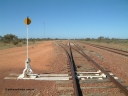
030416 095258501 viewsWirrida Siding, looking south towards Tarcoola with the goods siding and points rejoining the loop, notice the points are on timber sleepers while the loop and mainlines are on concrete, train control 'pillbox' in the distance. Located at the 641 km from the 0 datum at Coonamia and 137 km north of Tarcoola between Carnes and Manguri on the Tarcoola - Alice Springs line. GeoData location. 1April 6, 2003.
|
|
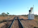
030416 083542494 viewsCarnes Siding located at the 566.4 km on the Central Australian line from Tarcoola to Alice Springs. View of the line and loop looking north from the south end with point indicator, interlocking hut and repeater signal and communications tower in the background. GeoData location. 1April 6, 2003.
|
|
|
|
|
| 65 files on 4 page(s) |
 |
4 |
|
 Login

